|
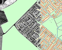
Hotmapping can turn your data into an
additional layer in any GIS system.
Click
here for
details. |
|
| |
|
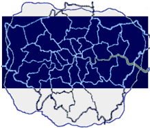
We have complete aerial infra-red heat loss
surveys for most of London available
immediately. Click
here for more
information. |
|
|
Two
brochures are available for download and can be
easily printed on single A4 sheets for distribution.
Right click and "Save target as" to download.
Left click to open now in a new window.
|
General
Georectification
|
London Thermal Data
|
|