|
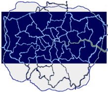
Hotmapping.co.uk have
complete aerial heat-loss data sets of most of
London and all of Norwich. Other locations may
follow, and specific areas can always be commissioned.
You can get an immediate quote for a colour coded
map of any area covered by our data starting from
0.5 sq km. Click
here to send us
your requirements.
The
surveys were carried out in 2000 by
Horton Levi Ltd,
specialists in thermal imaging. Using military
specification equipment and flying at approximately
2000 ft, the images reveal heat loss in remarkable
detail.
|
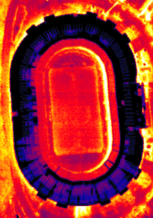
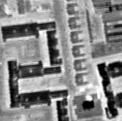
Thermal data is
recorded in monochrome to retain full
resolution. Conversion to colour
is useful for specific analysis and
presentation purposes.
|
|
 |
 |
|
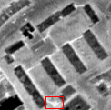
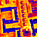
This image clearly highlights an
underground heating system. The
highlighted area reveals a leak in the
system which would otherwise be
undetected.
|
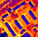
The
surveys can be used for many purposes. Housing
stock can be analysed for efficiency and larger
individual buildings can be analysed for weak
insulation points. Heat emissions from
factories can be identified and remedial action
taken. Housing Associations and local
authorities can study their entire stock from one
data set. Poorly heated housing can be
identified to help prevent winter deaths.
|
The benefits of
insulation programmes can be seen, and
housing in need of attention is easily
highlighted.
|
|
 |
 |
This data is available now. As well as
saving thousands of pounds on commissioning an
individual survey, you won't have to wait until
next winter which is when further surveys can
take place. Data is provided on CD-ROM in
monochrome and can be optionally colourised.
All the data can be geo-rectified and joined
together to provide
in a format suitable for your GIS.
|
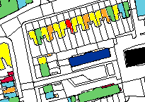
Using our therma-spatial
analysis system the data can be
interpreted and colour coded in your map
system. This enables fast analysis
of problem buildings. See
Services
for more details.
|
|
 |
Prices depend on the size of the area required -
contact us now
for an immediate quotation.
|