|
Georectification of aerial
images, such as thermal,
photographic and satelite data to
enable map overlay in all GIS
systems.
|
|
|
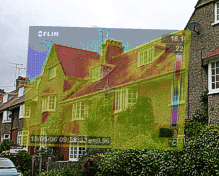
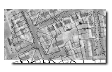
Aerial infrared heat loss surveys
and therma-spatial analysis allowing
colour-banding of infrared data for
easy identification.
Both new
and old survey data can be brought
to life. |
|
|
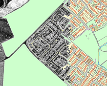
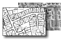
Historic aerial photographs can
be digitised and seamlessly joined
together for hard-copy or digital
presentation. |
|
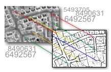
Geo-rectification is the
process of aligning graphical data on a two
dimensional surface so that it accurately
corresponds with a map projection system.
Hotmapping.co.uk specialise in georectification
services and
typically align layers such as aerial photographs,
satellite imagery (landsat) and infra-red data.
All
location based data can be turned into maps, colour
coded and georeferenced whether it be imagery or
statistical data.
Once
georeferenced the data can be installed in a GIS
system allowing direct comparison with other layers
within the application. Typically, these
layers include:
-
Map Data
-
Aerial photographic images
-
Information layer - such as an address database
-
User specific data such as topography, infra-red
and landsat data
-
Statistical data such as earnings, energy use
and population information.
The
rectification process is detailed and complex.
Each image is rectified individually, using multiple
GCPs (Ground Control Points) to accurately align the
input image with the reference image. A
transformation matrix can then be computed allowing
the input image to be resampled to match the map
data. |
|
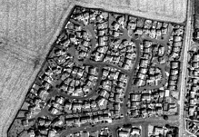
Ground images can be overlaid
with elevation drawings or
photographs for precise
identification of problem areas. |
|
|
|
Step 1
Formatting the image and map data ready for
georectifying.
 |
|
| |
|
Step 2
Using multiple Ground Control Points,
individual images are aligned with the map
data.
 |
|
|
|
|
Step 3 The
rectified images are joined together to
form a seamless mosaic.
 |
|
|
|
|
Step 4
The combined image map is projected using map
co-ordinates so that it can overlay the map
data in your GIS software.
 |
|
|
|
|
|
|
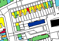
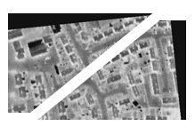
Individual images are then stitched together to form
a mosaic - a map of images - that can be viewed over
the original map data.
Analysis of thermal data can be hugely
simplified with our therma-spatial analysis system.
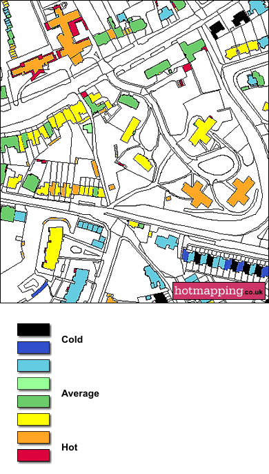
The
above screenshot is taken from a GIS system and has
been created by taking the average pixel value of
each building from the thermal data and attributing a colour banding to
it. This enables at-a-glance identification of
problem properties which are either losing
significant amounts of heat or may be inadequately
heated. We believe that 8 colour codes achieve
the right balance between detail and simplicity, but
this can be increased or decreased according to
requirements.
All
our geo-rectification is carried out in-house -
unlike many service providers we do not out-source
abroad. This allows us, and our customers, to
control the process from start to finish, and if any
discrepancies arise in alignment, they can be
rectified (so to speak) immediately.
For
more information, please call us on 01263 722655 or
contact us
here. |